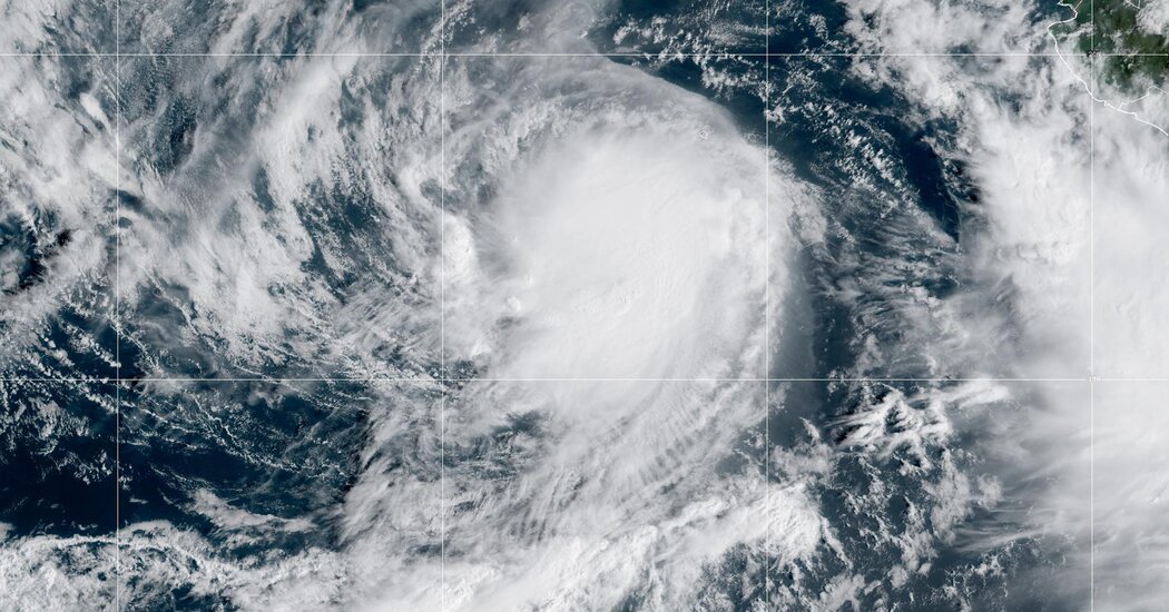
Tropical Storm Lidia is anticipated to strengthen to a hurricane and make landfall on the west coast of Mexico by Tuesday, bringing heavy rains that may trigger flooding and mudslides.
The storm was about 410 miles south-southwest of Baja California, Mexico, in the Pacific, and had sustained winds of 70 miles per hour, with higher gusts, according to the National Hurricane Center. Once a storm’s winds exceed 74 m.p.h., it is considered a hurricane.
Little will change on Sunday, but Lidia is expected to strengthen on Monday and make landfall as a hurricane on Tuesday.
It’s unclear exactly where on Mexico’s west coast Lidia will make landfall, but it is projected to approach land at the Islas Marías, off the coast of Nayarit, Mexico, and the coast of west-central Mexico on Tuesday, the Hurricane Center said.
Exact population estimates for the areas that might be affected weren’t available but AccuWeather meteorologists said it will likely hit a “sparsely populated area.”
The Mexican government issued a hurricane watch for Las Islas Marías and for the coast of west-central Mexico from Playa Pérula to Mazatlán. A tropical storm watch was posted from Mazatlán to Bahía Tempehuaya and from Manzanillo to Playa Pérula on Sunday.
Lidia is expected to produce four to eight inches of rain — and in some areas up 12 inches — through Wednesday across the southern portions of the state of Sinaloa, western portions of Nayarit and coastal portions of the state of Jalisco in southwest Mexico, the Hurricane Center said.
These rains will likely produce flash and urban flooding, along with possible mudslides in areas of higher terrain near the coast.
Swells from Lidia will affect the west coast of Mexico and the Baja California peninsula over the next few days. These swells will likely cause life-threatening surf and rip current conditions.
Models indicate Lidia will make landfall as a Category 1, Alex DaSilva, a meteorologist with AccuWeather, said on Sunday.
The waters are warm enough for Lidia to intensify but meteorologists don’t expect it to strengthen further because of wind shear, meaning that the wind will change direction, disrupting the storm’s formation.
A hurricane made landfall in Nayarit in late October last year. That storm, Hurricane Roslyn, was a Category 4 hurricane that contributed to the deaths of four people, according to the Hurricane Center.
“That was a much more significant system,” Mr. DaSilva said. “While we don’t expect it to be of that strength, we are always concerned about the flooding downpours.”
Areas inland on the west coast of Mexico have mountainous terrain, meaning that a lot of rain there can lead to mudslides, washouts and other flooding issues, he said.
A separate tropical depression or storm could form by late on Monday from a cluster of thunderstorms off the southwestern coast of Mexico, AccuWeather said. That system could also bring heavy rain and gusty winds, forecasters said.


