


After spinning across the Atlantic for more than a week, Hurricane Lee is slowly nearing land and is forecast to affect the Northeast United States and Canada as early as Friday.
In anticipation of the storm, hurricane and tropical storm watches have been issued for most of coastal New England and parts of Canada.
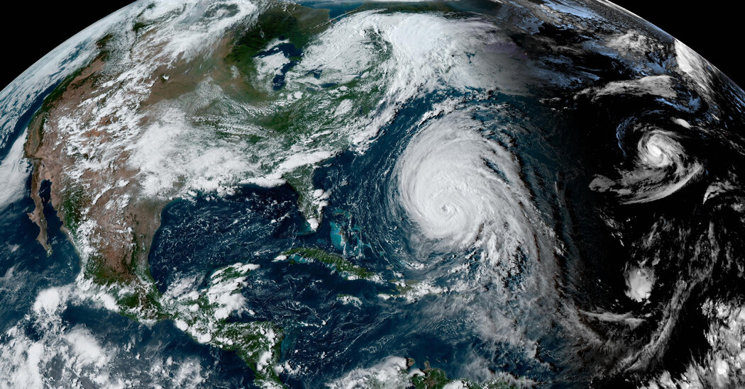
Here are three things to know about Hurricane Lee.
-
Forecasters in Bermuda expect the brunt of Lee’s damaging winds to arrive there on Thursday into Friday, as the storm’s center passes west of the island.
-
After the storm passes Bermuda, it is looking more likely that it will turn toward the Gulf of Maine and probably make landfall between Maine and Nova Scotia.
-
Because the storm is so large, hazards like heavy rain, wind and flooding are expected to be felt far from the center, regardless of where landfall occurs. Impacts are expected in New England and Atlantic Canada as soon as Friday.
It’s been nearly two weeks since speculation about the storm’s impact on the East Coast began. On Wednesday, the eventual outcome was becoming more apparent, though precise details remained difficult to predict with certainty.
As of 5 a.m. on Thursday, Lee was about 295 miles southwest of Bermuda, where tropical storm conditions were expected within hours, the National Hurricane Center said in an advisory.
The storm had maximum sustained winds of 100 miles per hour, making it a Category 2 storm, and was moving north at nine m.p.h. Some weakening was expected over the next two days, the Hurricane Center said, but it would probably remain “large and dangerous” into the weekend.
Hurricane forecasters confidently said on Tuesday that the storm was expected to move north after passing Bermuda. By Friday night and into Saturday, Lee was expected to turn slightly left, bringing the large hurricane close to southeastern New England. A hurricane watch, meaning hurricane conditions are possible within the area, stretched through down-east Maine from Stonington to the U.S.-Canada border.
The Canadian Hurricane Center also issued a hurricane watch on Wednesday for part of the provinces of New Brunswick and Nova Scotia. The center said that its hurricane and tropical storm watches referred to conditions expected on Saturday.
There is still some uncertainty about what will happen this weekend. Landfall will probably occur late Saturday night into Sunday somewhere along the Maine or Nova Scotia shorelines. The expected turn back west will likely allow for the storm to track across the Gulf of Maine.
Forecasters warned that the growing size of the storm means hazards will extend well away from the center.
The ultimate outcome for locations in New England will depend on how a few different conditions play out over the next few days. The amount of rainfall will vary significantly depending on precisely where the storm comes ashore, and the forecast rainfall amounts are likely to shift until the very last minute.
Anne Strauser, a meteorologist with the National Weather Service, said that the worst-case scenario for Maine would be if the storm shifts farther west and creates more onshore flow, which could make coastal flooding worse. She said that any storm surge that occurred there would vary depending on the tide cycle. Unlike when a hurricane makes landfall in the southern United States, and the tides vary by a few feet, the tide swings in Maine can be from eight to 18 feet. So a storm surge at low tide might not have much of an effect.
Despite this, coastal erosion and flooding are a real concern. Dangerous surf conditions generated by the storm are already affecting much of the Eastern Seaboard.
Governor Kathy Hochul of New York said on Tuesday that she was deploying National Guard soldiers to prepare for the storm on Long Island, “out of an abundance of caution.” She warned New Yorkers in coastal areas to watch the forecast and be prepared.
‘It’s just going to get wider.’
As the storm heads north over the next three days, it will weaken as it moves over cooler water. And as it approaches land, it’s likely to transition from a tropical system — one that gets its energy from the ocean — into one similar to Hurricane Sandy’s, which drew energy from competing cold and warm air masses.
While weakening is good, it will not diminish the potential impact of wind, rain and coastal flooding. “This storm is already on the larger side for a hurricane in terms of how wide it is,” Ms. Strauser said. “And it’s just going to get wider as it moves north.”
In Canada, officials are concerned that because of Lee’s broadness, it is likely to affect most of the Maritime Provinces and parts of eastern Quebec.
Hurricane-force winds extended up to 105 miles from the center of the storm early Thursday, and tropical-storm-force winds extend to more than double that distance.
On Wednesday, forecasters suggested that their five-day probabilities for tropical-storm-force winds at certain locations, which are displayed below, were likely underestimating their likelihood.
Western Nova Scotia faces some of the highest possible impacts from Lee, Environment Canada said.
And while New England is no stranger to extreme winds from intense nor’easters, Ms. Strauser noted that those arrive in winter — and that it makes a difference. This time of the year, there are still leaves on the trees and during tropical systems like Lee, the region typically sees more tree damage and, ultimately, more widespread power outages.
Melina Delkic, Anastasia Marks, Eduardo Medina, Mike Ives and Derrick Bryson Taylor contributed reporting.